


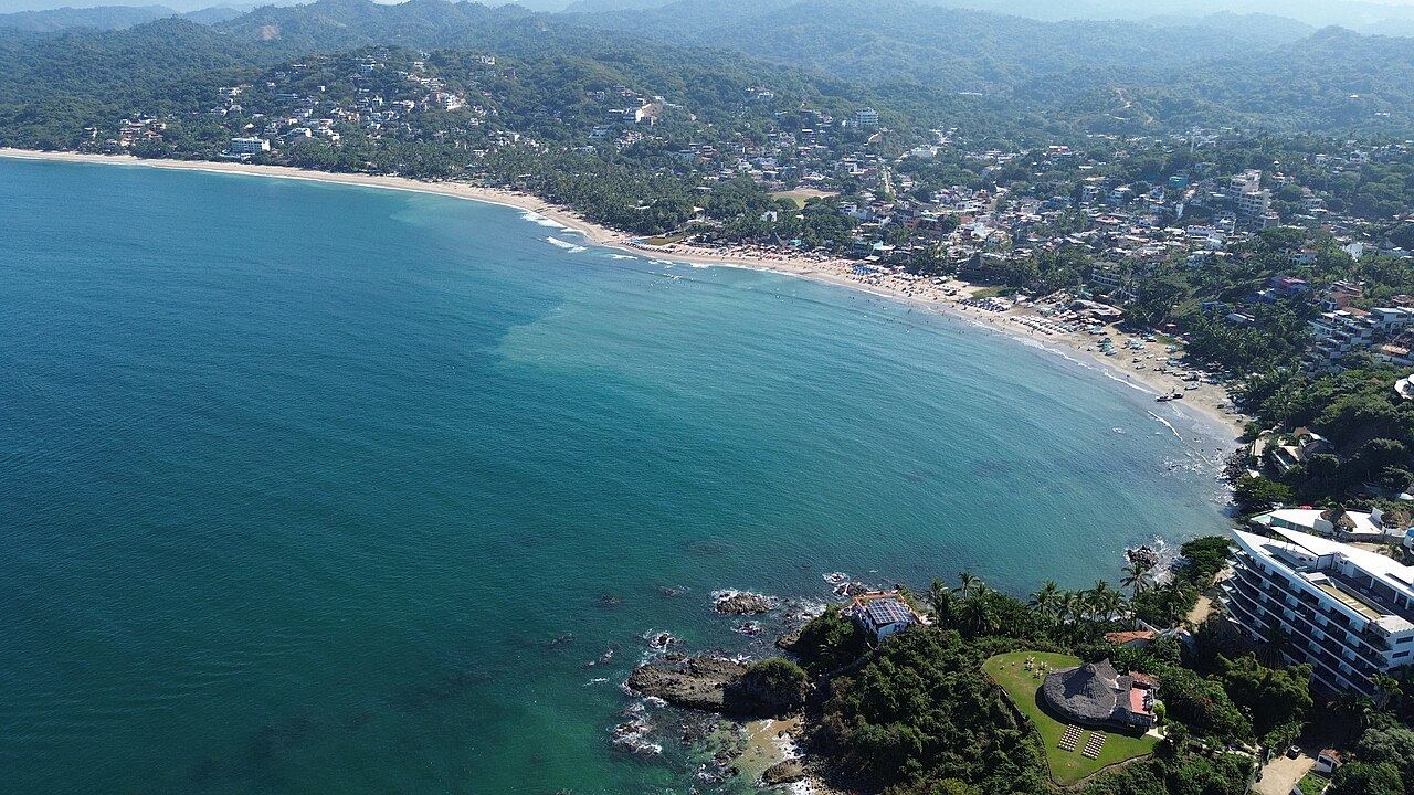
Sayulita's town beach is one long bay, and the right spot on it depends on what you want: a lesson, a swim with small kids, or a quiet chair at sunset. Past the headlands at each end are smaller beaches you reach on foot, with fewer people and no services.
The short version: swim at the south end or at Los Muertos, learn to surf in the middle, and treat the open beaches beyond as places to walk and look rather than swim.
The main beach, end to end
The south end, toward the point below the Villa Amor hill, is the calmest stretch and the one parents pick for small children. It is lined with beach clubs and restaurants that rent loungers, so you can stay all day without walking back to town.
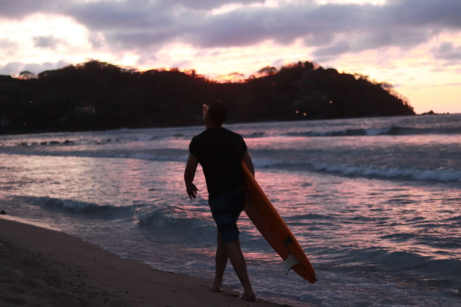
The middle, in front of the parked pangas, is the lesson zone: a sandy bottom and slow, forgiving waves. Just north of it the river meets the sea, and that is where Sayulita's two point waves break, a right over sand and scattered rock and a quicker left beside it. This part is full of boards, so swim elsewhere.
Cross the river mouth and you are on North Beach, backed by villas and palms and noticeably quieter. The shore break here can be stronger, which suits walkers, readers and sunset drinks more than toddlers.

Playa Sayulita
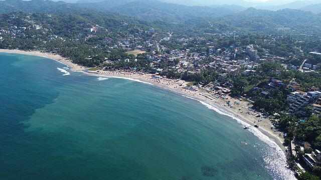
The town beach, a short walk from the plaza, with surf schools, loungers and food along its whole length.
4 min walk to the next
Taboule Beach Club
Loungers at the quiet southern tip, the easiest stretch of the main beach for a proper swim.
2 min walk to the next
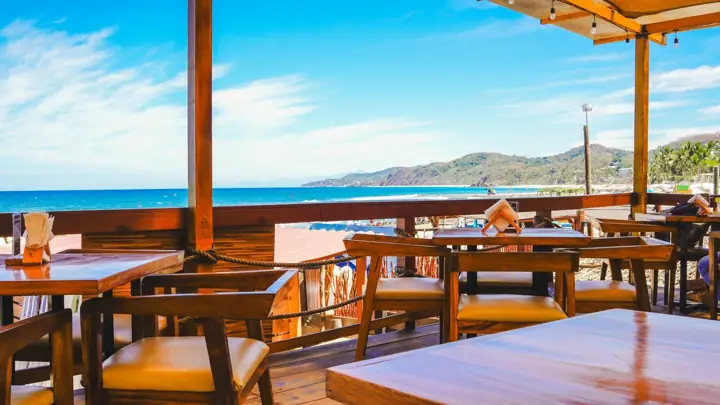
The Dock Sayulita
A south-end terrace where the water is calmer and the seafood is fair value.
3 min walk to the next
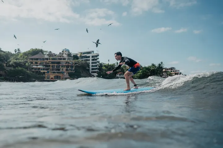
Lunazul Surf School & Shop
Surf school on Marlín, a minute from the beginner waves in front of the boats.
3 min walk to the next
Ancla Sayulita
Loungers right in front of the main break, good for watching the surfers. Check the bill.
14 min walk to the next
Playa Sayulita Norte (North Beach)
The quieter north side of the bay, about ten minutes' walk from town.
5 min walk to the next
Bar Miramar
A small north-beach bar that opens around sunset, for a drink facing the water.
With dates on your trip, this goes on a day.
Playa los Muertos: the one for swimming
Los Muertos is a small cove just south of town, tucked between rocks on both sides, and it is the easiest place near Sayulita for a calm swim, paddleboard or float with kids. On small days the water can be almost flat, though rips and bigger sets still turn up, and there is no lifeguard.
It takes about 15 minutes on foot. Either follow the beach road south past the Villa Amor end of the bay, or come over the hill from downtown on the steeper streets and down the dirt lane through the town cemetery, which gives the beach its name. The cemetery is worth a slow look, especially around Día de Muertos.
In June 2025 the municipality and federal authorities knocked down a 35-meter wall that had been built on the federal beach zone beside that dirt lane, reopening the path walkers had always used. Expect a few vendors, rental loungers and umbrellas, and paid toilets. It is quieter than the main beach on weekdays and fills up on weekends, so come early.
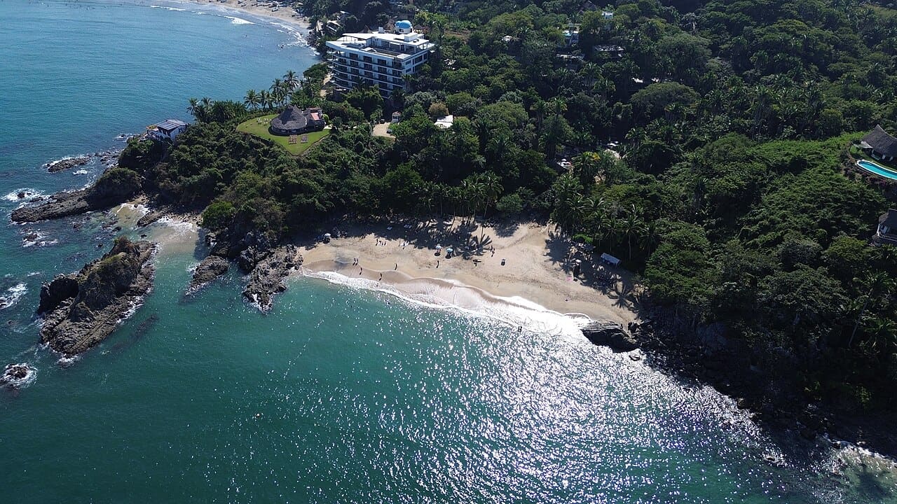

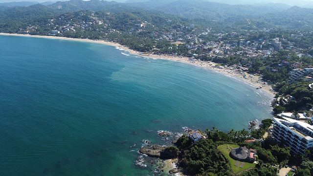
Playa los Muertos
Sheltered cove south of town, the calmest swimming in the area on small days.
1 min walk to the next
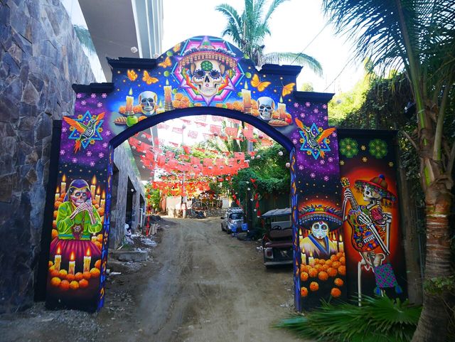
Los Muertos Cemetery, Sayulita
The hillside cemetery you walk through on the way down; painted graves under the trees.
5 min walk to the next
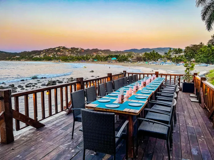
Sí Señor Sayulita
A meal over the water at the Los Muertos end, for when you want shade and a table.
With dates on your trip, this goes on a day.
Playa Carricitos and Patzcuarito: south, wild and open
Carricitos is the next beach south, a long curve of sand backed by palms, often nearly empty. From downtown it is about 20 to 30 minutes on foot: go up past the cemetery toward Los Muertos, keep going on the dirt road over the hill and follow the small signs down to the sand. There are no services, so carry water and shade.
This is open Pacific with a heavy shore break, boulders in the water and strong currents. Most people walk, picnic and watch the sunset here rather than swim; if you go in, stay close to shore on a small day.
Patzcuarito lies further south toward Punta de Mita. People reach it either on a long walk of about an hour from town or with a short drive out along the Punta de Mita road and then a walk of about 20 minutes on a path through palms, since vehicles can't go all the way. The waves pound hard and there is nothing there, which is the point.
Playa Carricitos
Wide, quiet beach 20-odd minutes south on foot; good for a walk and the sunset, not for swimming.
23 min walk to the next
Playa Patzcuarito
A remote beach off the Punta de Mita road, reached on a palm-lined path; bring everything you need.
With dates on your trip, this goes on a day.
Malpaso and Las Cuevas: north over the headland
North of North Beach, past the end of the road, is Malpaso, a mile-long undeveloped beach between Sayulita and San Pancho. Next to it is Las Cuevas, a horseshoe cove framed by cliffs and small caves, joined to Malpaso by a passage through the rocks that floods at high tide.
In 2025 the old jungle path toward San Pancho was closed for a Belmond hotel development behind the beach. After a community march that May, the developers and the municipal and state governments agreed to keep public access and protect the path as an ecological trail; meanwhile people reach Malpaso along the shore from the north end. Ask locally before you set out, because the route can change.
Both beaches face the open ocean, with rip currents and a strong shore break. They are for walking, photos and an hour of quiet, not swimming. Some people skip the walk and go round by panga from the main beach.
Playa Malpaso
Long, empty beach between Sayulita and San Pancho, with rocks and small caves at the ends.
9 min walk to the next
Playa Las Cuevas
Cliff-framed cove next to Malpaso; time it for low tide so the rock passage stays open.
With dates on your trip, this goes on a day.
San Pancho: the next town up
San Pancho (San Francisco on the map) sits about 7 to 9 km north, a short taxi ride. Its beach is long and straight, with a powerful break that suits experienced surfers and can make swimming dangerous on bigger days; the water tends to be gentler toward the south end.
It is quieter than Sayulita, with a few beach bars and chair rentals, and a good place for a sunset and dinner in town. The local turtle project, Grupo Ecológico de la Costa Verde, runs hatchling releases in season; check with them for dates.
Water quality, from the official tests
Mexico's health regulator, Cofepris, tests the water at tourist beaches before Easter, summer and the winter holidays. In its spring 2025 round Playa Sayulita was one of six beaches nationwide over the limit of 200 enterococci per 100 ml.
The state government put it down to a drainage problem in town. Once that was repaired, new samples came back clean, and Nayarit's state health commission, with Cofepris, declared the beach fit for recreational use in mid-April 2025. Sayulita has not appeared on any list of unfit beaches since: summer and winter 2025, Easter 2026 and summer 2026.
Each round is a snapshot, so look for the latest Cofepris results before a holiday trip.
Questions people ask
Is it safe to swim at Sayulita beach?
Yes, on most days at the south end, away from the surfers in the middle. Watch for rips on bigger swells; the calmest swimming nearby is at Playa los Muertos.
Is the water in Sayulita clean?
Cofepris found high bacteria levels in spring 2025, the cause was fixed and the beach was declared fit that April. It has passed every official round since, through summer 2026.
How do you get to Playa los Muertos from Sayulita?
Walk about 15 minutes south, along the beach road or over the hill and down through the town cemetery. A cart works too, but the small lot fills up on busy days.
Can you walk from Sayulita to Malpaso?
Yes, from the north end of North Beach along the shore; the old jungle path was closed for hotel construction in 2025. Go at low tide and ask locally first.
Which Sayulita beach is best for kids?
Playa los Muertos, or the south end of the main beach. Both are calmer than the middle, where the surf lessons are.
Written by sayulita.co from our own research, checked against 16 sources. Nothing here is paid for. Photos: Luisalvaz (CC0) (CC0); Gustavoarroyofotos (CC BY-SA 4.0); Luisalvaz (CC0). See something out of date? Tell us.
