


Surf report
Sayulita’s main beach and 22 spots from Chacala to Punta de Mita, from the same live models, every ten minutes.
Live · updated in the last 10 min
Share on WhatsAppThe weather today
Sayulita now · 9:15 pm
83°
Clear
Feels like 94° · High 85° · low 80°
- The sea 87°
- UV 7 · high
- 83% humidity
- 2% chance of rain
The next seven days
- TodayClear80°85°
- TomorrowStorms28%81°85°
- MonStorms43%81°85°
- TueDrizzle80°85°
- WedDrizzle80°85°
- ThuDrizzle35%78°83°
- FriHazy77°83°
A typical October: 32 °C (90 °F) by day, 23 °C (73 °F) at night, the sea about 31 °C (87 °F), some rain; swell around 1.8 ft from the WSW. The year, month by month · Forecast from Open-Meteo for Sayulita, cached ten minutes. °F
Sayulita main beach, right now
The spot2–3 ft
Knee to waist Good
Knee to waist and light cross-shore, with a long-period swell. Best look tomorrow around 6 am–8 am.
- Swell
- 2.6 ft at 12 s from the SW, plus 1.1 ft WNW
- Wind
- 8 km/h light cross-shore from the NE
- Tide
- 0.1 m, falling low 10:56 pm, 0.0 m
- Water
- 31°C · 88°F boardshorts and a rash vest
- Light
- 7:03 am – 6:26 pm
The week at the main beach
Hour by hour. Hover or tap for any hour; tap a day to jump.
Now1–2 ftFairlight cross-shore wind, 9 km/h from the NNEtide 0.2 m, rising · high at 4:43 am
- Wave faces at the spot; the band is the range
- Rating, flat to great
- offshore cross onshore wind
- night
Around the bay, right now
Best first. Tap a spot for its hour-by-hour and how to get there.
- El Anclote30 min drive · beginner3.5–5.5 ftGoodlight offshore
- Stinky's30 min drive · beginner to intermediate4–6 ftGoodlight offshore
- Swimming Pools35 min drive · beginner to intermediate3.5–5 ftGoodlight offshore
- Veneros35 min drive · intermediate3–5 ftGoodlight offshore
- Colorine70 min drive · advanced2.5–4 ftGoodlight offshore
- Lo de Marcos beach25 min drive · beginner to intermediate2.5–4 ftGoodcalm, glassy
- El Faro30 min drive · advanced4–6 ftGoodlight offshore
- Lo de Marcos south point25 min drive · intermediate to advanced2.5–4 ftGoodcalm, glassy
- Carricitos30 min walk · advanced3–4.5 ftGoodlight cross-offshore
- El Skupa30 min drive · intermediate4–6 ftGoodlight cross-offshore
- Las Islitas150 min drive · beginner to intermediate3.5–5.5 ftGoodlight cross-offshore
- La Lancha25 min drive · beginner to intermediate3–4.5 ftGoodlight offshore
- Burros30 min drive · intermediate3–4.5 ftGoodlight offshore
- La Caleta70 min drive · advanced2.5–4 ftGoodlight offshore
- Stoners150 min drive · intermediate to advanced3.5–5.5 ftGoodlight cross-offshore
- Litibú20 min drive · beginner to intermediate3–4.5 ftGoodlight cross-shore
- La Bahía (The Cove)30 min drive · intermediate to advanced4–6 ftGoodlight cross-offshore
- Malpaso / Las Cuevas50 min walk · advanced3–4.5 ftGoodlight cross-shore
- Patzcuarito / Patzcuaro60 min walk · advanced3–4.5 ftGoodlight cross-shore
- Sayulita main beach4 min walk · beginner2–3 ftGoodlight cross-shore
- Ostionesby boat · intermediate3–4.5 ftFairlight cross-offshore
- San Pancho15 min drive · intermediate to advanced3–4.5 ftFairlight cross-shore
- Punta Sayulita8 min walk · beginner to intermediate2–3 ftFairlight onshore
The week around the bay
The best daylight hours at each spot, each day: bar height is the size (wave faces in feet), its colour the rating. The ring marks each spot’s best day.
| Spot | Today31 | Tmrw1 | Mon2 | Tue3 | Wed4 | Thu5 | Fri6 |
|---|---|---|---|---|---|---|---|
| Sayulita4 min walk | 4.5 | 4 | 3.5 | 3.5 | 4 | 3 | |
| La Lancha25 min drive | 4.5 | 4.5 | 3.5 | 3.5 | 3.5 | 3 | |
| San Pancho15 min drive | 4.5 | 4 | 3.5 | 3.5 | 4 | 3.5 | |
| Burros30 min drive | 4.5 | 4.5 | 3.5 | 3 | 3.5 | 3 | |
| El Anclote30 min drive | 6 | 5.5 | 4.5 | 4 | 4.5 | 3.5 | |
| Stinky's30 min drive | 6 | 5.5 | 4.5 | 4 | 4.5 | 3.5 | |
| Litibú20 min drive | 5 | 4.5 | 3.5 | 3.5 | 3.5 | 3 | |
| La Bahía30 min drive | 6 | 5.5 | 4.5 | 4 | 4.5 | 4 | |
| Lo de Marcos25 min drive | 4.5 | 4 | 3.5 | 3.5 | 4 | 3.5 | |
| El Faro30 min drive | 6 | 5.5 | 4.5 | 4 | 4.5 | 3.5 |
- Flat too small to ride
- Poor small, or messy wind
- Fair surfable, with a catch
- Good clean, the right size for the spot
- Great clean and solid: the spot at its best
Ratings are for each spot on its own terms: 3 ft can be good at the main beach and too small at a point that needs 5.
Every year on the main beach
The Sayulita Longboard Contest
Once a year the town's longboard contest takes over the main beach for three days: stylish longboarding in the Open and Junior heats, the Kahuna division, an aerial show and heats after dark under lights, with half the town watching from the sand.
The 2026 contest ran October 16–18
The 2026 divisions
- Open1,499 pesos · cash prizes
- Junior499 pesos · cash prizes
- Kahuna499 pesos · prizes in kind
- Aerial show499 pesos · cash prizes
- Night heats999 pesos · cash prizes
Every division is open to women and men, and every entry comes with a competitor's kit.
The contest's siteIn the calendar
It moves around the calendar (the 2025 edition ran December 11–13); next year's dates go up on the contest's site first.
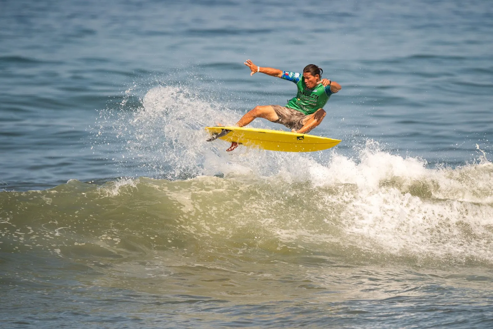
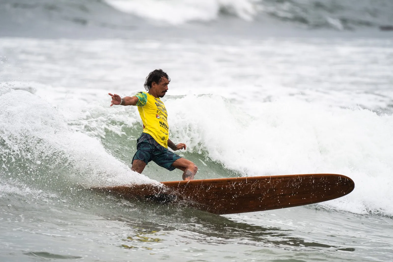
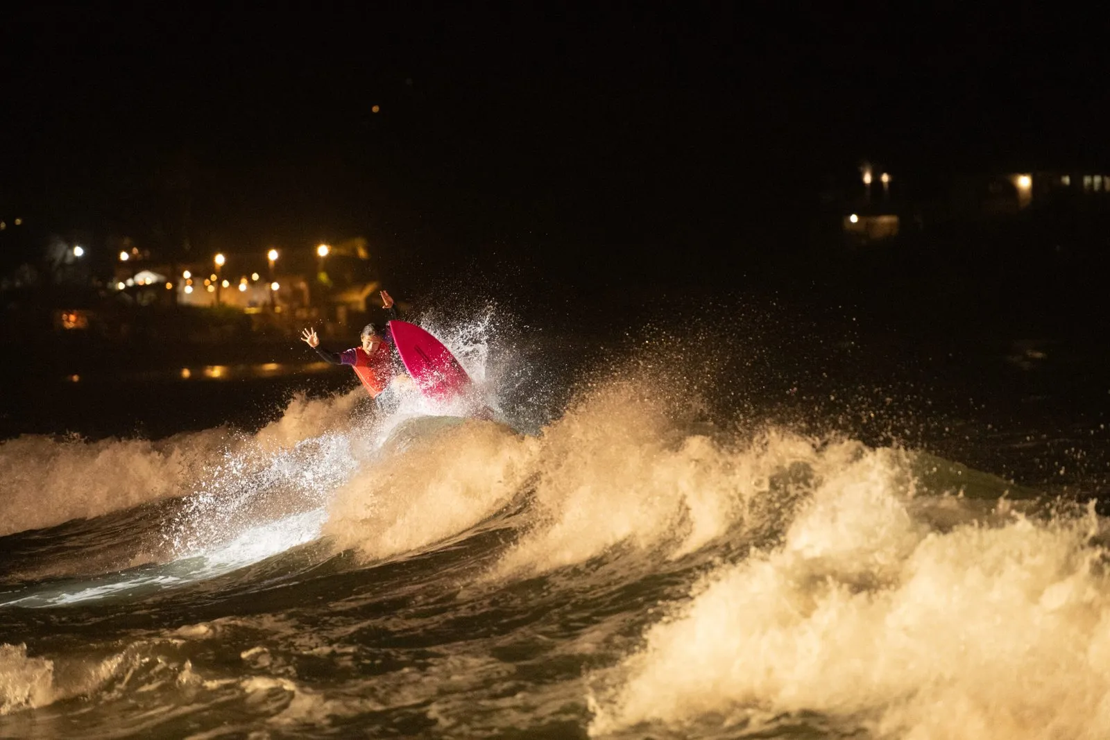
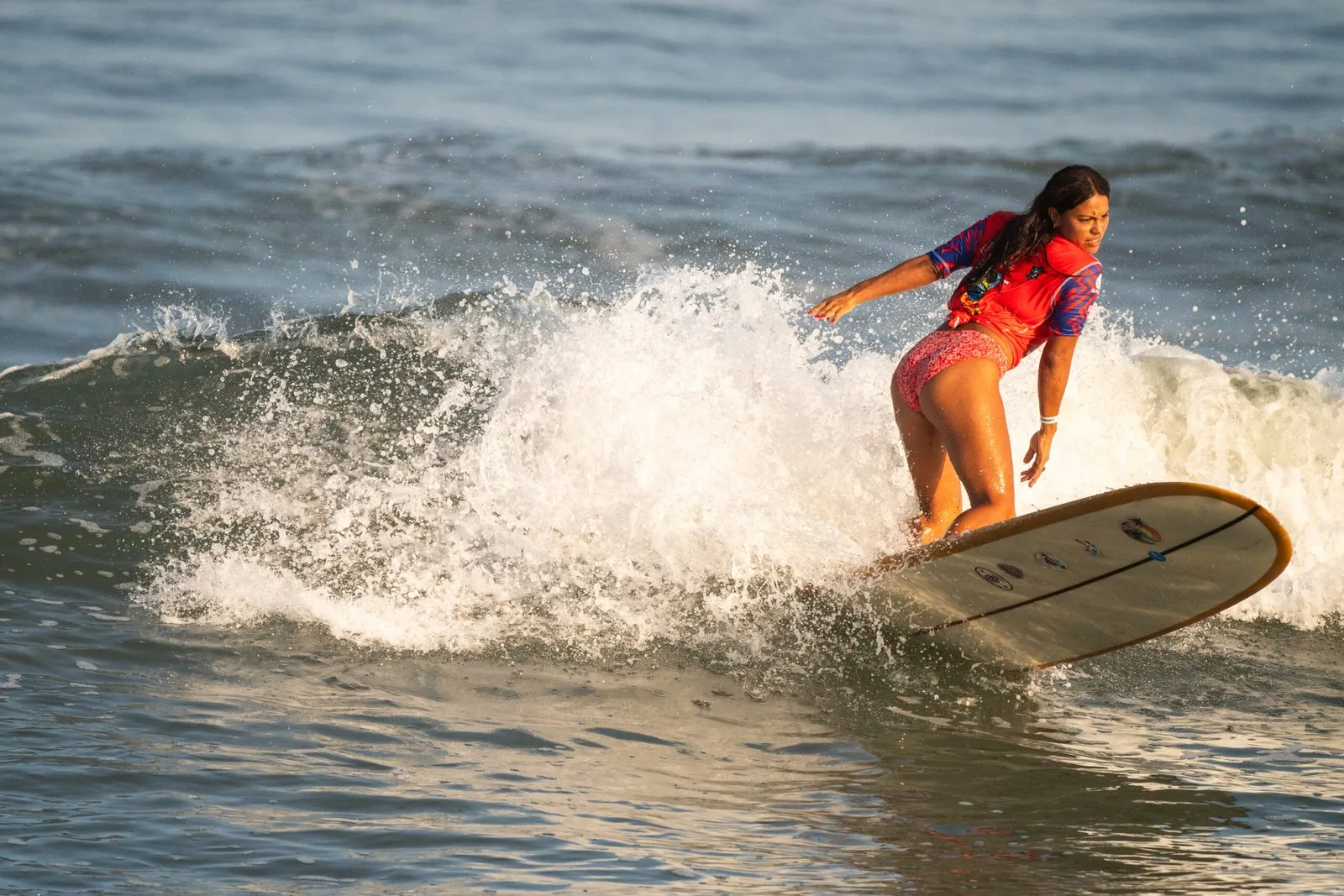
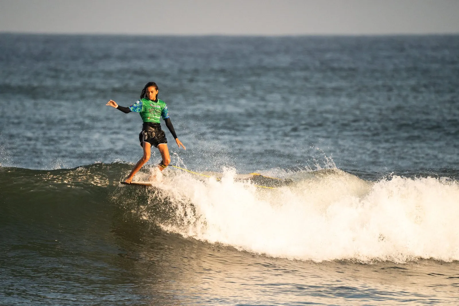
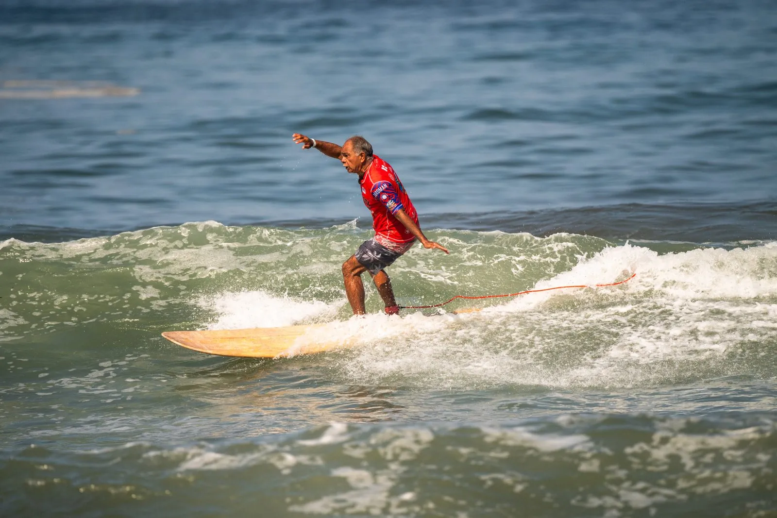
Photos and film from the 2024 contest by Sabino, from the contest's own site and YouTube. Three days of the 2024 contest in a few minutes: long rides on the main beach, the crowd on the sand and the heats after dark.
Sports & adventure around the bay: the year's contests and races, and everything else to do outdoors.
Next in surf
- Day of the Dead international surf tournamentOctober 29 – November 1 · Main beach, SayulitaThe third edition of this contest has shortboard, longboard, SUP, bodyboard and adaptive divisions, plus a dog-surfing exhibition, with 478,000 pesos in prizes. Athletes meet at Hotel Sayulinda on October 28 at 6pm; finals and awards are on November 1.
- Sayulita named Mexico's first official Surf CityNovember 2 · SayulitaTourism officials will formally give Sayulita the Surf City title during the Day of the Dead celebrations. Venue and times haven't been announced.
Water
Fit for swimming
Official test at Sayulita, verano 2026 (June 2026): 32 enterococci per 100 ml, against a limit of 200. Cofepris results
Tests run three times a year. After heavy rain, stay away from the river mouth for a day or two.
The year, month by month
Averages: air from our month guides, the sea and swell from Open-Meteo's 2016–2025 records.
| Month | Day / night | Sea | Rain | Swell | Sunset |
|---|---|---|---|---|---|
| Jan | 82° / 63°F | 76°F | dry season | 2.4 ft WNW | 6:42 pm |
| Feb | 82° / 63°F | 76°F | dry season | 2.1 ft WNW | 7 pm |
| Mar | 84° / 63°F | 75°F | dry season | 2.1 ft WNW | 7:11 pm |
| Apr | 86° / 64°F | 76°F | dry season | 1.8 ft W | 7:21 pm |
| May | 88° / 68°F | 80°F | dry season | 1.8 ft W | 7:32 pm |
| Jun | 90° / 73°F | 84°F | some rain | 1.8 ft WSW | 7:44 pm |
| Jul | 90° / 75°F | 87°F | rainy season | 1.5 ft SW | 7:46 pm |
| Aug | 91° / 75°F | 88°F | rainy season | 1.7 ft SW | 7:31 pm |
| Sep | 90° / 75°F | 88°F | rainy season | 1.9 ft SW | 7:05 pm |
| Oct | 90° / 73°F | 87°F | some rain | 1.8 ft WSW | 6:37 pm |
| Nov | 88° / 68°F | 83°F | dry season | 1.7 ft WNW | 6:21 pm |
| Dec | 84° / 64°F | 80°F | dry season | 2 ft WNW | 6:23 pm |
Know before you paddle out
The seasons
- Winter: northwest swells Nov–Apr
Smaller, cleaner swells from the north and northwest, glassy mornings and light winds. The best time to learn, and the town's busiest months for crowds.
- Summer: south swells May–Oct
Bigger, heavier swells from the south and southwest and passing storms. Punta de Mita, San Pancho and the points north wake up; surf early, before the afternoon onshore wind and rain.
- Storm season Jun–Nov
Distant hurricanes can send big swells and strong rips. Check the storm notice at the top of this page and official advice before you paddle out.
This month, typically: water 31°C (87°F), swell about 1.8 ft at 9 s from the WSW (2016–2025 averages, Open-Meteo, CC BY 4.0).
Stay safe
- Don't count on a lifeguard being on duty; at the main beach, stay in front of the surf schools.
- Rips run hardest near the river mouth and on bigger swells: paddle across them, not against.
- Rocks and sea urchins sit under the points and the river-mouth right; booties help.
- After heavy rain the river carries runoff into the north end of the beach; give it a day or two.
In the lineup
- The surfer closest to the peak has the wave; don't drop in.
- Paddle wide of the lineup, not through it.
- Hold on to your board; learners stay inside, away from the main peak.
- Lessons and rentals stay in front of the schools, not on the point.
Lessons, rentals and shapers
- Avex Surf Campsurf school
- Costeño Surf Schoolsurf school
- Juicyyy Surf Sayulitasurf school and juice bar
- Lunazul Surf School & Shopsurf school
- Mainland Surfboardssurfboard shaper
- Marea Surf Schoolsurf school
- Mexican Surf Mafiasurf school
- Pancho Surfboard Rentalssurf school
- Patricias Surf Shopsurf school
- Sayulita Cruz Surf Campsurf school
- Sayulita Surf Centersurf school
- Sayulita Surf Co.surf school